Select Project > Field Networks > [SORIS network].
Select the SORIS tab.
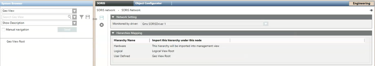
Open the Hierarchies Mapping expander. NOTE: By default, every hierarchy is assigned to Management View only.
Define the geographical view as the target of the import of the objects hierarchies as follows: a. In System Browser, select the geographical view from the drop-down list. b. In the tree structure, select the root node of the view and drag it to the User-Defined field in the Hierarchies Mapping expander.
Once configuration data is discovered, the imported hierarchies of objects will be automatically built according to the geographical level.